Keeping Mining Sites Safe with Drone Monitoring
Mining sites are busy, dangerous places. Heavy machinery, unstable slopes, loose overburden, active blasting areas, and steep pit walls create multiple high-risk zones. Small errors in geotechnical monitoring, road maintenance, or stockpile management can result in injuries, landslides, equipment damage, or operational shutdowns. For this reason, modern mines increasingly rely on remote sensing tools to eliminate unnecessary human exposure to danger.
This case study explains how a mining company deployed drones (UAVs) to transform site safety protocols. With drone monitoring, they inspected slopes, stockpiles, and haul roads more frequently, more accurately, and with significantly reduced field risk.
The Problem

A large open-pit mine operating in a remote mining region was facing three key safety issues:
Unstable pit walls and bench slopes posed collapse risks, and ground teams often missed early signs such as micro-cracks, bulges, bench erosion, or rockfall precursors.
Rapidly accumulating stockpiles were difficult to measure accurately using manual GPS or walking surveys, exposing staff to slips, collapses, and poor footing.
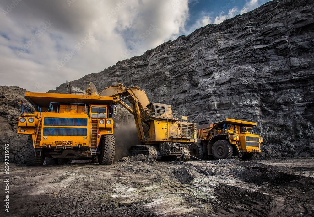
Haul roads had blind corners, inconsistent widths, drainage issues, and degraded surfaces, creating rollover or collision risks for 100-ton haul trucks.
Site managers knew they needed a modern, data-driven method to check these areas without sending people into unpredictable or unsafe environments.
The Drone Solution

The company brought in our drone team, specialized in mining safety, geotechnical mapping, and drone-based volumetric surveys. Here’s how we helped:
Slope Monitoring

The steep walls of the pit can collapse if they aren’t monitored closely. Drones survey the slopes for cracks, bulges, or signs of movement.
Previously, geologists and surveyors conducted risky slope inspections by climbing up and down benches or driving close to unstable walls, significantly increasing exposure to rockfalls.
Now, drones keep people out of harm’s way while giving higher-resolution, measurable data.
● Drones flew systematic grid missions along pit walls and benches and captured overlapping images for photogrammetric processing.
● High-resolution oblique and nadir images were collected for 3D reconstruction.
● The team processed photogrammetric models, DSMs, and point clouds to spot cracks, bulges, and changes over time.
● Geotechnical engineers received automated alerts showing deformation zones, enabling early intervention before failure.
Stockpile Measurement

The mine has large stockpiles of ore and waste rock. Knowing the volume is critical for reconciliation, production planning, inventory management, and accurate financial reporting.
Drones take photos from multiple angles and create true-to-scale volumetric models with centimetre-level accuracy. These models are more accurate than traditional RTK walking methods or manual estimates and eliminate unsafe climbing.
● Drones flew over stockpiles every week.
● Georeferenced 3D models were created from the drone images.
● The team could see exactly how much material was added, removed, or displaced across each stockpile zone.
● No staff needed to walk on unstable surfaces, reducing fall and collapse hazards.
Haul Road Inspection

Trucks move tons of ore daily. Any problem on a haul road, like surface degradation, loose material, rutting, blind spots, inadequate drainage, or insufficient road width can cause accidents or slowdowns.
Drones conduct linear corridor inspections to verify compliance with haul-road design standards, including berm height, gradient, visibility, and crossfall.
This helps the maintenance team act quickly and keep trucks running safely.
● Drones flew along haul roads on automated corridor paths for full coverage.
● The team looked for road defects, sharp curves, erosion channels, improper signage, and drainage failures.
● They made sure road markings, signage, and berms met safety requirements and visibility was good.
● Unsafe spots were prioritized and repaired sooner, preventing vehicle incidents.
The Results
After 6 months of drone monitoring, the mining site saw significant improvements:

Safety reports also improved, because drone datasets provided measurable, time-stamped, georeferenced evidence. Managers could make better choices based on Orthomosaics, 3D terrain models, and automated geotechnical change-detection layers.
What Workers Said
“We don’t have to climb unstable benches or approach hazardous pit walls or walk near moving trucks anymore. The drones give us everything we need without putting people at risk.” ~Site Safety Officer
“The drone maps are far more detailed and accurate than anything we used before. We can spot problems before they become safety-critical failures.”~ Mine Engineer
Conclusion: Flying Toward a Safer Future
Drones are helping mining companies protect their workers and improve safety.
They make it easier to manage risky areas like slopes, stockpiles, and haul roads without exposing staff to dangerous terrain or unstable geological zones.
For mining operations of any size, drones offer a modern, data-driven approach to safety, efficiency, and operational awareness, allowing teams to prevent hazards, improve planning, and maintain safe, productive mines.